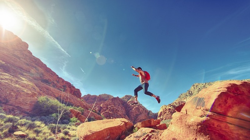
Ultimate Two Week Hiking Road Trip Itinerary
2 Weeks Hiking Northwest Parks
Contents
We flew into and spent the night in Vegas, drove down to Los Angeles and San Diego for a bit, and then went on a proper road trip. From Vegas to Southern Utah to Northern Arizona and back, in two weeks, with lots of National Parks, State Parks and National Monuments along the way.
After our trip ended, we created this two week USA road trip itinerary that includes some of the most stunning natural landscapes in all of the United States.
Even though there are about 20 different parks along the way, don’t worry about the cost. National park entrance fees are super low if you know how to do it right. The most important thing will be to get an annual pass for all national parks. You can just buy this at the first park entrance you go to. It only costs $80 for a car and all the people in it! That is quite a bargain considering one single park is usually $15 to $30 to get into for a few days. This includes national parks and national monuments, whereas state parks in fact do cost extra. Lots of them are five or ten dollars though, so nothing to worry about.
The best strategy is usually to be in one place for a night, then drive elsewhere for the next night, and see stuff along the way. Note that most National Parks offer enough to get lost on its trails for weeks. If you have a limited amount of time though, this itinerary allows you to see a whole lot of stuff in a short period of time, but without it getting too stressful.
We’ll also give you a rough idea of motel prices along the way. Keep in mind these can vary greatly depending on the season and type of motel. The prices given in the text roughly represent the average for a basic but good motel in the summer months. If you’re just fine with the cheapest place in town, expect to pay about a third less. There are some creepy places around though!
Obviously, there often is no limit on how much you could spend if you wanted to.
Day 1: Valley of Fire
From Las Vegas to St. George / Hurricane / Springdale
After a night or more in Las Vegas, start driving out of the city northbound on I-15.
The Valley of Fire is just over an hour drive from Las Vegas and features some of the most picturesque rock formations in Nevada.
The most scenic way will be turning off I-15 onto Valley of Fire Highway, then take Mouse’s Tank Road through the middle of the amazing state park and back. While in the park, make sure to check out some of their amazing trails.
Pretty much all of them will be accessible from Mouse’s Tank Road, winding through the park:
If you’re here in summer though, only wander out knowing that you can take extreme heat. A ton of water is obviously a must as well.
Once back by the visitor center, keep going along the Valley of Fire Highway until you reach Nevada State Route 169, turn north and drive until it crosses the I-15 again to head further north.

With Zion National Park on your list for the next morning, the destination for tonight should be either St. George, Hurricane, or Springdale. They’re getting closer to Zion – and thus more expensive – in that order. During summer, you’ll pay roughly $250 for a motel in Springdale (5 minutes from the park), as opposed to $130 in Hurricane (20 minutes from the park) and $80 in St. George (an hour from the park).
Day 2: Zion
From St. George / Hurricane / Springdale to Panguitch / Hatch
Do yourself a favor and wake up early for this one. Zion has a lot to offer and takes a while to explore. You don’t want to miss out on that. Additionally, in summer you can’t drive your own car through the park, but have to hop on a shuttle bus instead. On summer mornings they run super frequently (like one after another frequently), but even so the wait to get on might be up to one hour! Additionally, parking spots in the park will be filled by about 9am in high season. After that, you might have to use the park-and-ride service in Springdale.
Once on the bus, you’ll have to decide which stop to get off at. The most iconic hikes are Angels Landing or The Narrows (don’t underestimate these!), but there are tons of other ones as well. Info on Zion National Park with all the trails and much more you’ll find here. After all, Zion was the first ever National Park in Utah, which should speak for itself.
After completing your hikes in Zion, head towards Bryce Canyon. There are a few ways to go, but please make sure you’re going the scenic way, the Zion – Mount Carmel Highway.
This takes you up some switchbacks inside Zion Canyon and then through a pitch-black tunnel blasted into the canyon walls some 90 years ago. Upon exiting the tunnel, a beautiful scenery of orange-golden hills dotted with green trees awaits you.
Only a few miles later, the red sandstone will fully give way to grass and forest, with the backside of Bryce’s cliffs already towering in the distance. Once you reach Mount Carmel Junction, just turn north onto Route 89 and that’ll take you near Bryce.
Again, you can stay right by the Bryce park entrance and pay some ridiculous US$250, or you settle for a the night a bit further away. The town of Panguitch is the main stop for Bryce visitors with most motels starting just over US$100 in summer, but there are some small towns on the way up from Zion dotted along the route. Hatch is the closest village to Bryce, where we stayed at the railway-themed Hatch Station Motel for US$80.
Day 3: Bryce & Scenic Byway 12
From Panguitch / Hatch to Torrey
Only about half an hour from Panguitch or Hatch you’ll find the entrance to Bryce National Park. Bryce is almost as popular as Zion, but even in summer, you’ll still be able to drive your own car through the park. This is because the Bryce drive is on top of a wide plateau with lots of space for parking areas, compared to the narrow canyon forming Zion. Bryce is a fabulous national park especially if you don’t want to walk far. All the viewpoints are very accessible, since the drive goes pretty much along the rim.
However, to experience the stunning rock formations first hand, you should absolutely do some walking. There are a couple of trails with a good length of about one to three hours, venturing off from Sunrise Point as well as Sunset Point. Just be prepared for a bit of a parking issue at these two if you’re not getting the shuttle bus. For trail information and more click here.
Keep in mind: Bryce is among the coldest and most breezy national parks in the area. If you’re not going between mid-June and mid-August, you’ll most likely need a warm jacket at least in the morning hours. In winter, night temperatures often drop to -30°C / -22°F. The drive along the plateau is located at heights of up to 9,100 ft / 2,800 m, but nevertheless, summer temperatures can reach up to 35°C / 95°F on hot days. Be prepared!
If you’re craving some food by now, stop at “Pizza Place” in the village of Tropic, an amazing little restaurant.
Now, it’s still quite a bit of a drive to Torrey, the stop for the night. If you don’t want to do that and spend more time in Bryce instead, stay in Escalante for the night. It will be more expensive though.
The Scenic Byway 12 is really quite scenic all the way from Bryce to Torrey, but the best part goes from Escalante all the way up into the forest past Boulder. Breathtaking! Such beautiful landscapes.
The night in Torrey shouldn’t cost you more than US$90.
Day 4: Capitol Reef & Goblins
From Torrey to Green River / Moab
The next day won’t be too stressful. First on the list is Capitol Reef National Park, which isnt’t all that famous, but offers some amazing scenic roads along towering red cliffs. The settlement of Fruita, right at the start of Capitol Reef, is where the Information Center is located. This is also where the actual scenic drive forks off, which you should absolutely do, even though it’s not a thorough road.
Back in Fruita, if you want to do a little bit of hiking, you should consider walking the Cohab Canyon Trail. At least walk up the hill to the entrance of the little canyon, what a great view! Another popular trail leads to the Hickman Natural Bridge. You’ll find all the necessary info here.
And guess what, you’re in for some more super scenic roads! When done with hiking, just follow the Utah State Route 24 through the park and through Caineville. Your surroundings are now going to quickly turn into a moon-like landscape. Super grey and mountainous. Just insane, how many entirely different sorts of views you get within a couple of hours on the roads of Utah!
The next town will be Hanksville, where you’ll have to take a left turn to stay on Route 24. After a while, the access road to Goblin Valley State Park will be off to the left, in the middle of absolutely nowhere. Goblin Valley is a tiny place, but very unique and if you venture far enough into it, you’ll quickly escape the people walking around the first few Goblins. Just please follow the signs and do not step onto them, as sadly we saw many people doing. It should take the average visitor only about an hour from entering to exiting the park. If you want to find out more, head to this website.
After another two and a bit hours of driving, partly along I-70 East, you’ll be in Moab. Moab is an amazing place with a ton of natural beauty near it, and therefore will be expensive to stay at. For the first night, you may alternatively choose Green River, before heading into Moab the following morning. That’s because the average basic but solid motel in Green River will set you back US$70… In Moab, it can easily be twice that.
Day 5: Canyonlands & Highway 128
Moab / Green River to Moab
While in Moab, you’ll have to determine for yourself where to go for the sunrises, where to go for the sunsets, and where to go during the day. There are tons of options inside and outside of the three parks surrounding Moab.
An example itinerary could include a nice spot in Canyonlands National Park like Grand View Point or Mesa Arch for sunrise. Do leave Moab more than an hour before the actual sunrise though.
Afterward, head over to Upheaval Dome. It’s an impressive and massively eroded crater, of which you can partly walk the rim. When we went, it was super quiet despite being the middle of summer.
There also are a lot of nice viewpoints here and there along the roads as well. That means you don’t necessarily have to walk much to see the surroundings of Canyonlands. If you want to get some hiking done though, which I do recommend for every park, have a look at the trails here.
Depending on how much of Canyonlands you want to see, you can then have a much needed lunch break. In the afternoon head up to Cisco, a ghost town near the Colorado border, along scenic highway 128. It definitely is one of the prettiest roads I’ve seen outside a national park in my whole life. When you drive along it, you’ll see what I mean. On the way up from Moab to Cisco, go off on a little side trip into Castle Valley. If time allows, maybe even head up into the mountains!
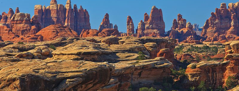
Then continue past Dewey, the place with the old bridge, towards Cisco. It might seem a bit creepy but it really is quite interesting. As of now (Summer 2017) there is actually a woman living in one of the old houses. Don’t worry about her, she’s a genuine person and just carries her gun in case of trespassing criminals.
The Amtrak California Zephyr train passes through Cisco every day at just after 5 pm. It used to stop here back in the day for refill water, but that’s not needed anymore… Which essentially is what made Cisco become deserted, along with the construction of I-70 completely bypassing the town.
On the way back, stop to watch the Fisher Towers glow red in the setting sun. If you’ve got a proper tele lens with you, stop near mile post 26 and watch the bright red Fisher Towers with the snow-covered peaks of La Sal mountains in the background and the Colorado River underneath them. If you do not have a telelens with you, you might as well get up and close to the towers and watch the sunset from there, which is at least as impressive. This shot looks a lot more amazing in winter:
Day 6: Dead Horse Point & Arches
Moab to Moab
Another day in the beautiful surroundings of Moab. Again, it’s completely up to your preferences where to go at what time of day for the best light conditions. An example could be Dead Horse Point State Park for sunrise and a nap after that. If you’re not feeling too tired, go experience some of the trails in the park. Unfortunately, we couldn’t witness this beauty with our own eyes yet, because we only had two nights in Moab and thus decided to skip Dead Horse Point, State Park.
In the afternoon, head over to Arches for some more stunning nature like Delicate Arch, Devils Garden or Fiery Furnace. Keep in mind that Arches is up there with Zion and Bryce in terms of popularity. Thus, if you don’t like being around a ton of people, come here at odd hours. The park is usually open 24/7, meaning you could even go on some great hikes under the full moon. During our visit the park was closed at night, so we didn’t have that choice. But obviously, it was still amazing.
If you’re already out of the park before sunset, watch the sky turn red from Moab Sunset Grill. It’s a really cool restaurant sitting right atop a cliff in Moab, with absolutely superb views. Another (more affordable) place we can seriously recommend after a long day of exploring is the Moab Brewery!
Day 7: Needles District, Natural Bridges, Goosenecks and many more
From Moab to Mexican Hat / Bluff
So, time to move on. Monument Valley is the next big thing on the list, so we’ll move south from Moab. If you get up early, a side trip to the La Sal Mountains might be worth it. If not, you should head straight towards Needles Overlook and / or Big Spring Canyon Overlook. It is quite a detour and even though we did originally plan to go, we ended up not having enough time. That was because we saw Arches on that same morning.
The Needles District is actually the southern part of Canyonlands National Park. Its many small canyon formations are super unique and definitely worth some overnight hiking trips if you’re into that.
Once back on the main road, head further south until you’ve passed Blanding. Turn right onto Utah State Route 95 and follow this scenic drive.
Keep going on the 95 (which also takes you past the Butler Wash Ruins) for a good 30 minutes until the 275 turns off to the right, taking you to the Natural Bridges National Monument. We were positively surprised by this place, as it seemed like we were almost the only tourists in the whole park, despite it being the middle of high season and many other parks had thousands of visitors in them!
A small scenic oneway road leads you around the park for about nine miles. There are a lot of viewpoints to stop along the way and some hikes as well. If you’ve got a considerable amount of time to spare, a walk through the entire riverbed is highly recommended. Even if not, at least take the short walk down to Owachomo Bridge, which is what we did.
Afterwards, take State Route 261 down towards the Mexican Hat. Be aware that part of this (the Moki Dugway) is a gravel road, but the views are absolutely incredible! We had no problem driving it in our Ford Mustang. I guess that means just about any car will be fine, as long as the road is dry. The Moki Dugway is quite a sight in itself, with sweeping views over the Valley of the Gods.
If you have a car with higher ground clearance than a Mustang, also don’t miss out on Muley Point. This is quite an impressive viewpoint just before going down the Moki Dugway. Unfortunately, the access road became quite soft and sandy at one point, so we decided to turn around.
Last stop for the day, after going down the Moki Dugway, is Goosenecks State Park. It’s merely a viewpoint and therefore only costs five dollars, but the view is indeed awesome! These are some of the largest meanders in the whole world and really quite impressive. The grey-looking landscape is a nice change from the all-too-common red rock in this area.
The night before seeing Monument Valley you should spend in Mexican Hat or Bluff. Mexican Hat has a notorious lack of decent accommodation, but there is one awesome yet affordable motel! It’s called the San Juan Inn and is an old former trading post situated right on the San Juan River. In summer, it should be around US$100 for a night. If you don’t want to spend that much, you should probably rather sleep in Bluff than in Mexican Hat.
Day 8: Monument Valley, Antelope Canyon & Horseshoe Bend
From Mexican Hat / Bluff to Page / Marble Canyon
Today is packed with more great photo opportunities. The first major sight will be Monument Valley. At the very start of it, you can take one of these super iconic shots.
This is best done in the morning as the sun will be behind you. We actually came for sunrise since it’s not even 20 minutes from Mexican Hat, however, that was mainly for “emptiness” purposes, as the photos themselves will still be as good if not better until just before noon. You’ll have a harder time later though, with more tourists around and the road being a lot busier.
Continue along US Highway 163 past El Capitan / Agathla Peak which is an old and eroded volcanic plug, through Kayenta, onto US 160, and then onto Arizona State Route 98 towards Page. Shortly before getting to Page, there are Upper and Lower Antelope Canyon pretty close to the road. These are some incredibly fascinating slot canyons, that I would consider some of the coolest and most unique sights in the world. Upper Antelope Canyon is wider, easy to walk and famous for its light beams in summer. Lower Antelope Canyon is a lot narrower, making it harder to navigate, but the corkscrew-like rock formations are stunning.
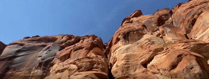
On the downside though, the tourism here literally sky-rocketed exponentially and still keeps doing so. When I first visited, they were already saying how crowded it had become “nowadays”. When I came back three years later, I couldn’t believe my eyes. For hundreds of cars, you need advance reservations, and even so, there are still waiting times of up to two hours on popular days. There are so many people down in the canyon, it’s really hard to take photos with nobody in.
If you feel like lunch/dinner, Fiesta Mexicana is a great restaurant in Page. Afterwards, head towards Horseshoe Bend, just a few minutes from here. The walk looks like a couple of minutes on the map, but be sure to bring your water as always. There is no shade at all around this area. For the best photos, you should either come between noon and early afternoon, or for sunset. Otherwise, half the canyon will be in the shade and the other half in the sun. You’ll either want all of it in the shade (plus a sunset in the back), or as little shade as possible. We couldn’t get the timing quite right, but it is still really impressive.
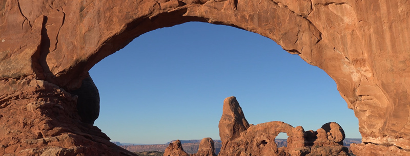
The page seems to be the only place around here where there are motels, and it’s expensive. I’d say at least on one level with Moab, possibly more costly. That leads us to search for alternatives and we found the Marble Canyon Lodge, which I totally recommend. We only paid US$75 for the night here, as opposed to US$150 in Page, and it’s definitely a decent place. It is half an hour of a detour, but it’s definitely worth it, not only because it’s cheaper. The lodge is situated beautifully right by the Colorado River and the drive is super scenic, especially during sunset.
Day 9: Grand Canyon
From Page to Williams / Flagstaff / Grand Canyon Village
This day you can completely dedicate to Grand Canyon National Park. If you’re not that much into hiking at all, you could instead put some of the next day’s stuff into today. Grand Canyon however is a hiker’s haven. You can totally spend multiple days exploring its trails, but even half a day will be good for a taste.
Driving along the South Rim from East to West, you’ll have a ton of viewpoints to stop at. On the map, it might not look like they’re all that different, but the truth is far from it! The variety these lookouts offer is staggering, despite they’re so close to each other! So yes, be sure to stop at each and every one of them.
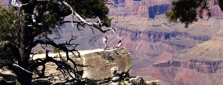
For spending the night, you’ve essentially got three options. Grand Canyon Village (super expensive), Williams (fairly reasonable), and Flagstaff (on the cheaper end). We chose Flagstaff, and that was a good option! It’s not only the cheapest, but the drive there is also the most scenic, along US Highway 180. It takes you past Humphrey’s Peak, the highest mountain in Arizona, and also home to Arizona Snowbowl, one of the three popular ski resorts in the state.
Basic but decent Flagstaff motels should be available from around US$70. In Williams, you can expect US$100 and up, while Grand Canyon Village will be more like US$250.
Day 10
Flagstaff to Sedona
Flagstaff to Sedona doesn’t cover much of a distance, but there are a lot of cool sights around the area. First thing in the morning, head to Barringer Crater, also known as Winslow Meteor Crater. This is the most accessible and well-preserved large meteor crater on earth. While it’s privately maintained and thus not cheap, it’s still worth it if you’ve never seen anything like it.
The next sight on the list is the Sunset Crater Volcano National Monument. Yes, there even are volcanic landscapes around here. Arizona and Utah literally have it all! While these volcanoes are not active anymore, they are still really young. Like less than 1,000 years young! The landscape quickly changes into an amazing contrast of black lava and green pine trees. Ideally combined with clear blue skies (or even an orange car), that looks pretty amazing! Even if you don’t want to walk far, which is certainly possible, still do a couple of their short walks.
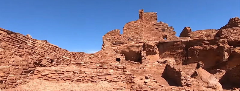
Continuing along the 395 Loop Road is quite scenic once again and will eventually take you to Wupatki National Monument. It cooperates with Sunset Crater as one park and consists of ancient pueblos. People built these here about 1,000 years ago, possibly drawn by the fertile ashes of the new volcanoes nearby.
By the end of the day, head down towards Sedona. Try and make it there before sunset, because otherwise the scenic road 89A will be closed and you’ll have to use the Interstate, which by far isn’t as pretty. This is Oak Creek Vista, about halfway from Flagstaff to Sedona along 89A:
Another great spot to get out the car is Midgley Bridge. You can just enjoy the view, or take the 15 minute walk down to the bottom of Oak Creek Canyon.
Day 11: Sedona
Sedona to Seligman
Around Sedona, there are quite a few nice spots to hike or just admire the rock formations. Do that for however long you like and then head towards Jerome. Jerome is a former mining town that boomed until about 1930. Its population then quickly fell from almost 5,000 to just about 100 people in the 1950s and has since made a very slow recovery to roughly 450 permanent citizens. Jerome is famous for haunted buildings such as the Jerome Grand Hotel. Many ghost hunters come here and many suspicious things have been reported.
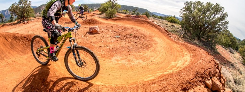
Jerome lies on a steep slope and the 89A starts winding up into the mountains right here. The next ten miles make for a great curvy drive if you have a nice car.
Check Out: Top 10 Most Beautiful Places in Arizona
Afterward, turn from 89A onto 89 and follow it all the way up to the I-40. Shortly thereafter, you’ll be able to turn off onto the Historic Route 66. And not only that – this is the longest continuous Route 66 stretch you can still drive along! It’s almost two hours, all the way into Kingman.
Kingman is a good place to sleep for the night. It’s cheap, there are tons of restaurants and it’s in a good location. Decent motels from US$80 should be available through most of the summer.
Day 12: Route 66, Oatman, Hoover Dam
From Kingman to Las Vegas
The way back to Las Vegas will start with one of my favorites: The arguably most beautiful part of Route 66 through the Black Mountains, across the Sitgreaves Pass, into Oatman. It’s best done during sunrise or sunset, but should still be amazing during the day.
Oatman itself is a cute little town that actually still looks like the typical western town. It almost became a ghost town after the construction of the I-40, but also managed a recovery because of tourism. Nevertheless, this is still not an overly popular place and we loved that! Also, everywhere around are wild donkeys or burros, just wandering the area.
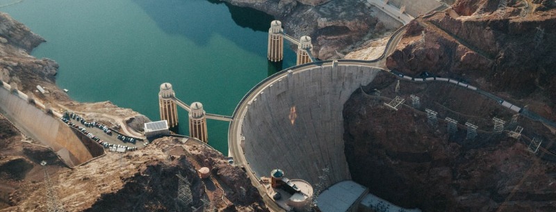
Next stop is Hoover Dam. Tip: If you drive across the dam to the Arizona side of it, there is some free parking over there! I can definitely recommend taking a guided tour of the dam. Seeing the outside is magnificent, but the inside is impressive as well and without a tour, you can’t get down there.
And then you’re back in Vegas. If you can manage to, don’t stay here on a Friday or Saturday night. Hotel prices are just horrendous. You literally get a five-star luxury strip hotel during the week for the same as a basic off-strip motel on a Friday or Saturday. Staying Thursday or Sunday night will give you the best mix: Parties are still on but prices are low. Monday to Wednesday night, nightlife can be a bit slow. Also make sure to avoid big conventions or festivals as that can easily quadruple hotel prices.
Day 13: Optional day trip from Las Vegas to Death Valley
Death Valley from Las Vegas
If you feel like visiting the Death Valley as well, you can do this as a daytrip from Las Vegas. The hottest, driest and lowest National Park in the United States, as it calls itself, has a lot more to offer than just scorching heat. When you go the way displayed on the image above, you’ll be able to see most of the popular spots. Zabriskie Point, Furnace Creek, Artist’s Palette, Badwater Basin, and much more. Maybe you’ll even get up to some hiking, although you might want to skip that in summer: Temperatures do surpass 50°C / 122°F fairly regularly and Furnace Creek holds the world record for the highest ever recorded temperature of 56.7°C / 134°F… Insane!
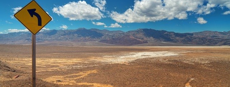
Somehow, I haven’t yet managed to visit Death Valley myself. But I did once plan to – and that is roughly what I came up with.
So there you have it, an epic USA road trip itinerary. Oh and last but not least… Americans don’t get a lot of days off work, so when they do, they make use of it. Thus, do not go to any of the parks during long weekends such as Memorial Day, Independence Day, Labor Day, or Easter. You’ll definitely enjoy the parks more on days with fewer crowds.

